…

| Location | Kakkabe > Virajpet (Nearest town) > Coorg / Madikeri (District) > Karnataka(state) > India (Country) |
| Distance from Bangalore | 260 KMS |
| Trek starting point | Near Kakkabe |
| Trek difficulty Level | Moderate |
| Tadiandamol trek distance | 4 KMS (one side) |
| Tadiandamol peak height | 1740 m |
| Time to trek | 6-8 hours |
| Camping site | At the foothills of the peak( a huge rock ) |
| Best time to trek | Oct to Feb |
| Permission | Not Required |
| Trekking fees | Nil |
| Contact Number | NA |
Thadiyandamol trek / Tadiandamol trek Information in details
Location on google map:
{google_map}12.217356,75.608768| type:terrain| show_info:no| zoom:14| width:1200 | height:480{/google_map}
How to reach from Bangalore:
If you are taking private vehicle then you can follow bellow route :
1) Bangalore –100Kms–> Mandya –26Kms–> Srirangapattana –20Kms–> Elivala–31Kms–> Hunsuru–45Kms–> Gonikoppa l–16Kms–> Virajpet–26Kms–> Kakkabe.
2) Bangalore—>Mandya—>Srirangapattana—>Mysore–>Hunsuru–>Kushalnagar–>Madikeri–>Kakabe.
Road condition of second route is better than first one.
Public Transport ( From Bangalore): Catch KSRTC buses to Virajpet from Satellite bus-stand . Then change bus to Bhagamandala, get down near Kakkabe (Aramane stop which is 2 Kms before Kakabe).
Tadiyandamol ( thadiyandamol ) Trek trail map
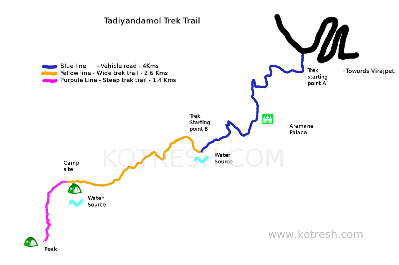
Mainly there are two trek routes. 1) Aramane / Palace route 2) Honey Vally route
Here is map of Aramane / Palace trek route. Peak is 8 Kms from main road(Main road is marked in Black colour).
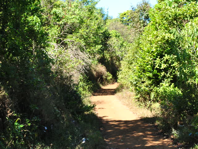
If you are travelling by public vehicle : Get down just 2 kms before Kakabe (from Virajpet side). Get down just after zigzag curve. you can request to stop at Aramane/Palace stop. This is your starting trek point which is marked as “Trek starting point A” in above map. You required to walk 4kms the road which is marked in blue colour in the map.
If you are travelling by private vehicle : If you are travelling from Virajpet route then just before kakkabe you will hit zigzag road which is marked in black in above map. Take left just after zigzag curve. You need to proceed in the this road for another 4 Kms (which is marked in Blue colour). Park your vehicle here and this will be your starting point which is marked as “Trek starting point B” in map.
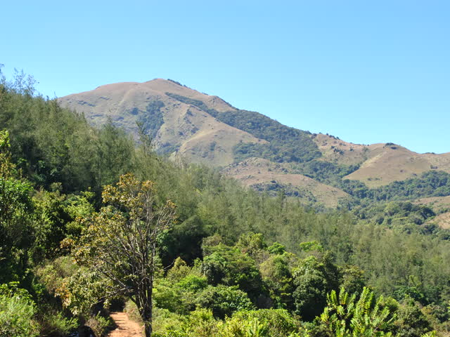
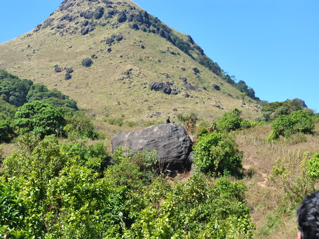
You will find small water stream here. You can fill water if you require. Route from here to foothill of the peak is around 2.6 Kms which is marked using “yellow line” in the map. This is mud road. Keep left in Y junction. This stretch is easy. After trekking 2.6 kms you will find big rock which is best place for Camping. You will find water source very much nearby. If you are planning to camp then this is best option. you will find plenty of wood for your fire camp. Wind will be much lesser than peak.
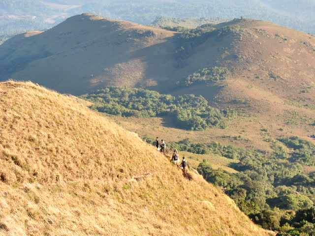
After this Big rock, peak is around 1.6 kms far. Trek trail is much steeper. This stretch is marked using “Purpule colour” in above map. you need to cross small stretch of sholla forest. Dont try to take any shortcuts. (We tryed out and missed our way for some time 🙂 ) Hardly 4 – 6 tents can accommodate in the peak. [Warning : On the peak there will be high speed wind. You check weather report just before going,] Just after rainy season finding wood for fire camp will be difficult, you need to carry this from base camp.
Tadiyandamol (Thadiyandamol) trek trek difficulty :
Stretch marked in blue line is very easy(4kms), Stretch marked in yellow line is easy (2.6Kms), Streach marked in Purple colour is Moderate.
Tadiyandamol peak height :
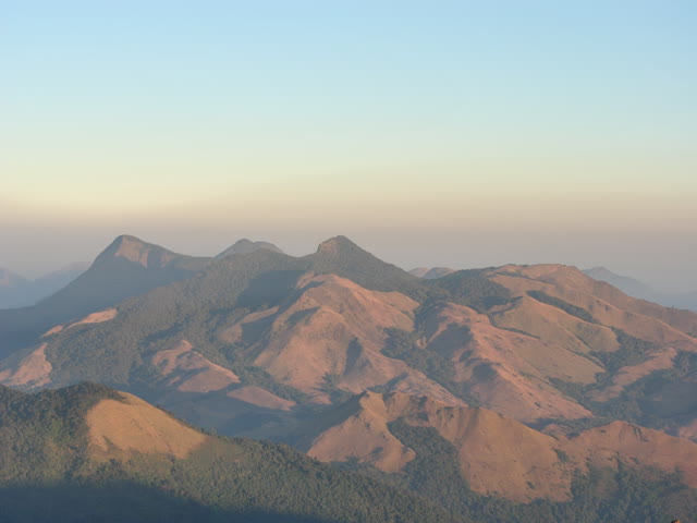
Tadiayandamol peak height is 1740 mts from sea level. This is second tallest peak in Karnataka . Tallest peak in Coorg.
Thadiyandamol trek trek distance :
You can find different answers in different blogs. Actually it depends on 1) which route you are taking 2)From where you are starting your trek. In Aramane/Palace route you can start your trek from main road which is marked as “Trek starting point A” in above map. Distance from “Trek starting point A” to Peak is 8 Kms one side. Trek distance from “Trek starting point B” to peak is 4 Kms .
Time to trek Thadiyandamol trek peak:
If you are starting from “trek starting point A” then it will take around 1-2 hour to cover initial 4Kms which is marked in blue color in above map. Next stretch is around 2.6 kms which is there till the foothill (till big rock) stretch is marked in yellow line in above map may take 1-2 hour . Last stretch is 1.4 Kms which is more steeper. It may take 2-3 hours. Total stretch from Trek starting point A to peak requires 4-7 hours one side. From Trek Starting point B to peak it requires 3-5 hours
Camping site at Thadiyandamol trek:
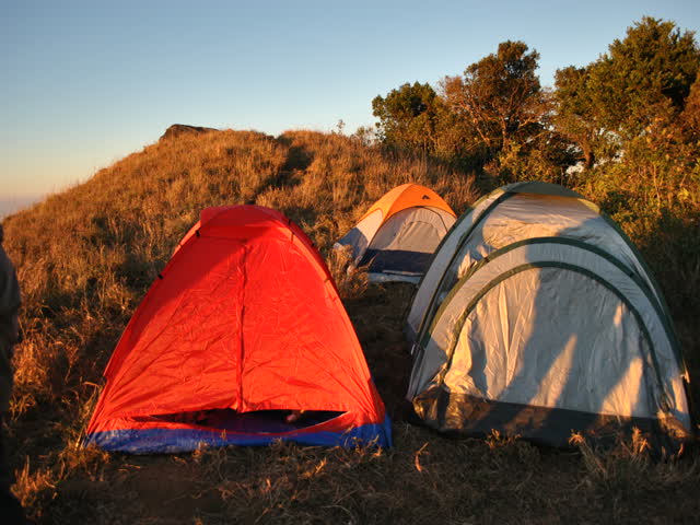
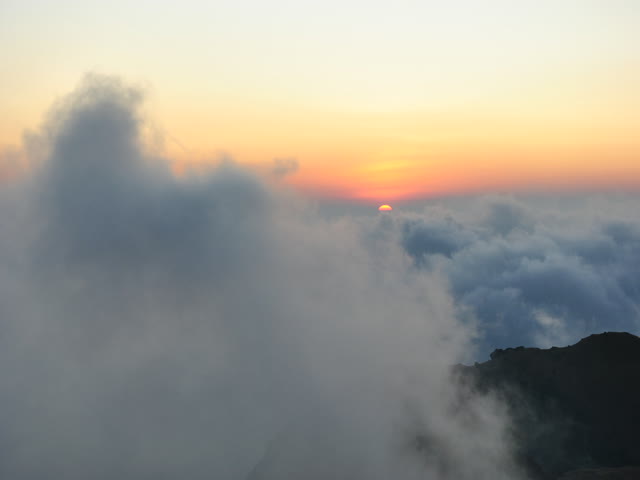
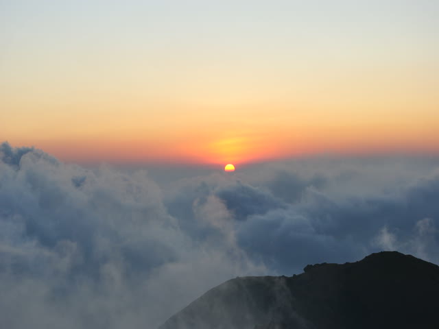
There are two best places for camp. 1) At the foothills of the peak that is near to the big rock. This is best place for camp. You will get water near by. Big rock gives you protection from water. Ground is flatter for camping. you will get wood for campfire. 2) At the peak. Only 4-6 tents will accommodate at the peak. So if you are trekking in long weekend then better reach early to the peak. But there is no water at the peak. so you need to carry. Normally high wind will be there at the peak so just check wind in weather forecast.
Warning : Please keep campfire overnight if you are camping at the foothills. This is because observed Elephants activity recently in this area